Street sections: design the street, not the ribbon
Open any feasibility study and look at the street. Too often it is a single number: 12 m, 20 m, "assume 18". A ribbon of constant width, a grey strip between two plots, drawn before anyone has decided who the street is for.
That number hides the decisions that matter most to the people who will live on it. How much of the 20 metres is for walking? Where do the trees go, and do they have room to grow? Is there a cycle track, and is it protected? Who gets loading, and who gets the middle of the road? A width answers none of this. A cross-section answers all of it, and until recently Spacio drew streets the first way.
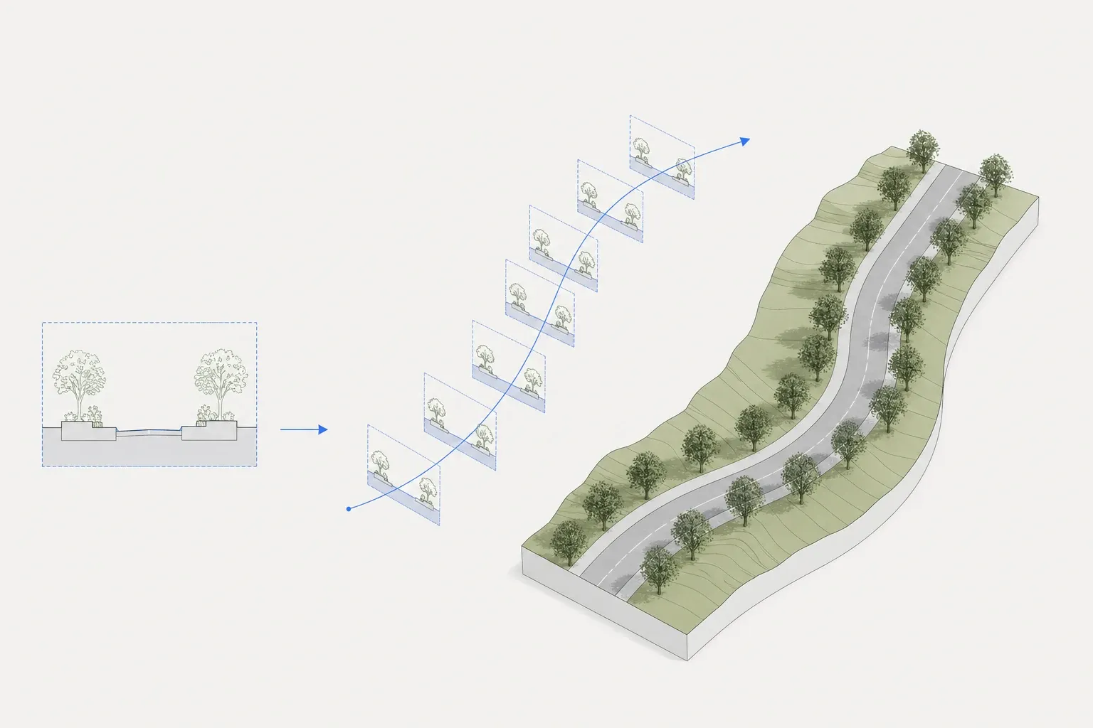
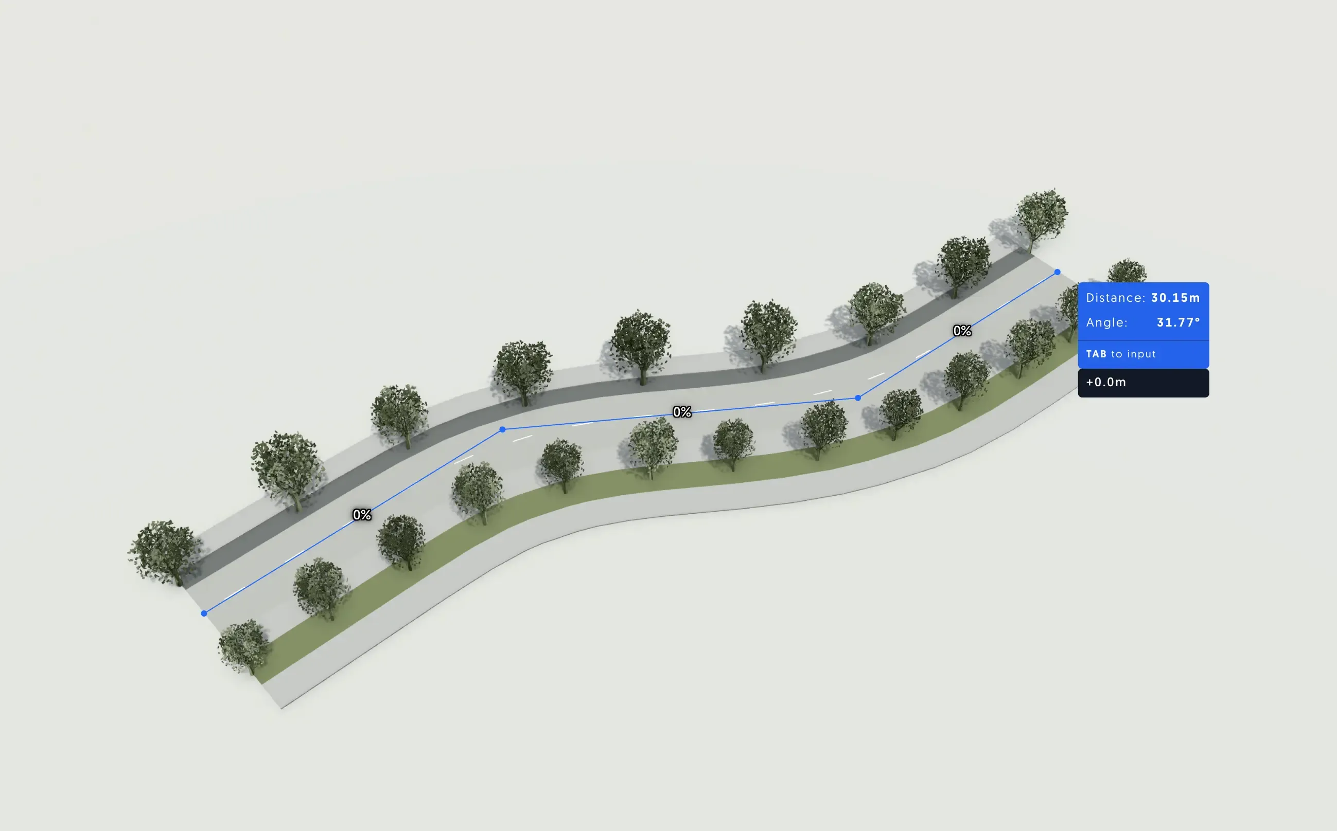 Since August 2026 a street in Spacio is a street section: a named, ordered list of lateral bands, stored on the project, assigned to a street and swept along its centreline in 3D. This post is about why that matters, and it borrows its argument from an unusually good source: a Swedish design guide for streets, applied to a real set of outer districts in Eskilstuna.
What the Swedish guidance says, in five principles
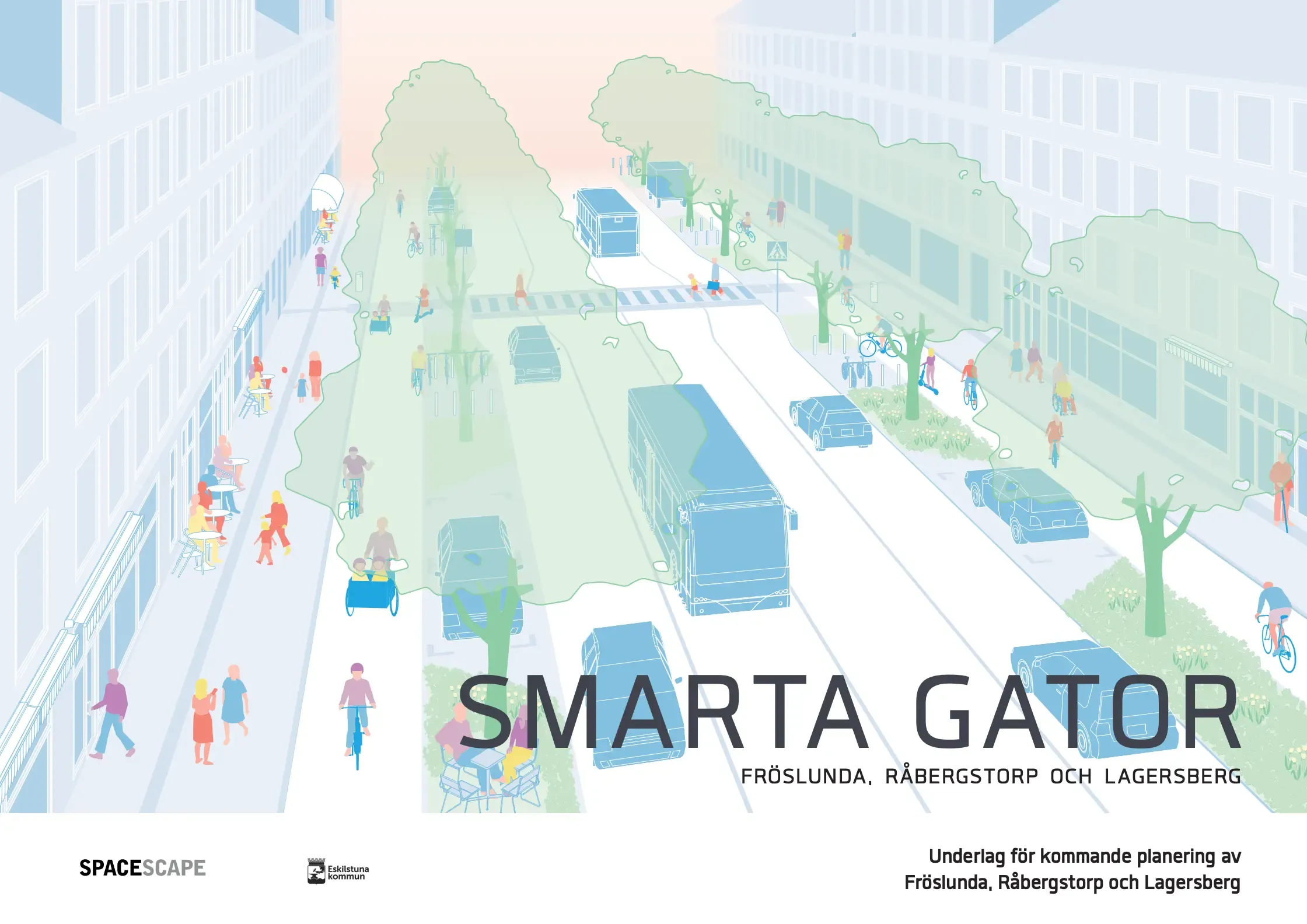
Smarta gator: Fröslunda, Råbergstorp och Lagersberg was produced by Spacescape for Eskilstuna kommun as part of its work on three 1960s and 70s districts, built on SCAFT traffic-separation principles, that the municipality is now repairing. It applies the research project Smarta gator (2019–2022) and its Designguide för smarta gator (2022) to a real street network. The source is in Swedish; I have translated and summarised it here, and I quote only a few words. The credit for the thinking belongs to Spacescape and Eskilstuna kommun.
The principles are what make it useful far beyond Eskilstuna. Five of them carry the argument.
1. Surfaces have a priority order. The guide ranks the functions of a street, social first and technical last, and then ranks the surfaces: pedestrians, then flexible use (loading, furniture, bike parking), then cycling, then public transport, and motor traffic last. In the document's own words, the street is a living environment on a small surface. Most feasibility studies reverse the order without noticing, because the carriageway is drawn first and the pavement is what is left over.
2. More than half the width is for people. Pedestrians go at the edges, faster traffic in the middle, and over half the street width goes to walking, cycling and flexible use. Avoid on-street parking; keep delivery within 25 m of an entrance.
3. Low speed is the foundation. The base speed in the guide is 20 (or 30) km/h, with 5 (or 10) on walking-speed streets and 40 (or 50) on the fast ones. For the network it suggests roughly half walking-speed streets, 30% low-speed streets and 20% main streets. Minimum lane width is 3 m for all modes, with 2.5 m of clear width kept for maintenance and emergency vehicles.
4. One level where possible. Boundaries between traffic surfaces are made by colour or ground material first, and a raised kerb is a secondary tool, because a street without kerbs stays flexible.
5. Streets should be rebuildable. Test with temporary furniture and ground paint first; make it permanent later.
None of this is a regulation, and none of it is Swedish in any way that stops it travelling to a Norwegian or Danish plot. It is a method for deciding who the street is for. The trouble is that a method like this needs a place to live in the model, and a single width is not one.
Rebuilding Section A as a Spacio street section
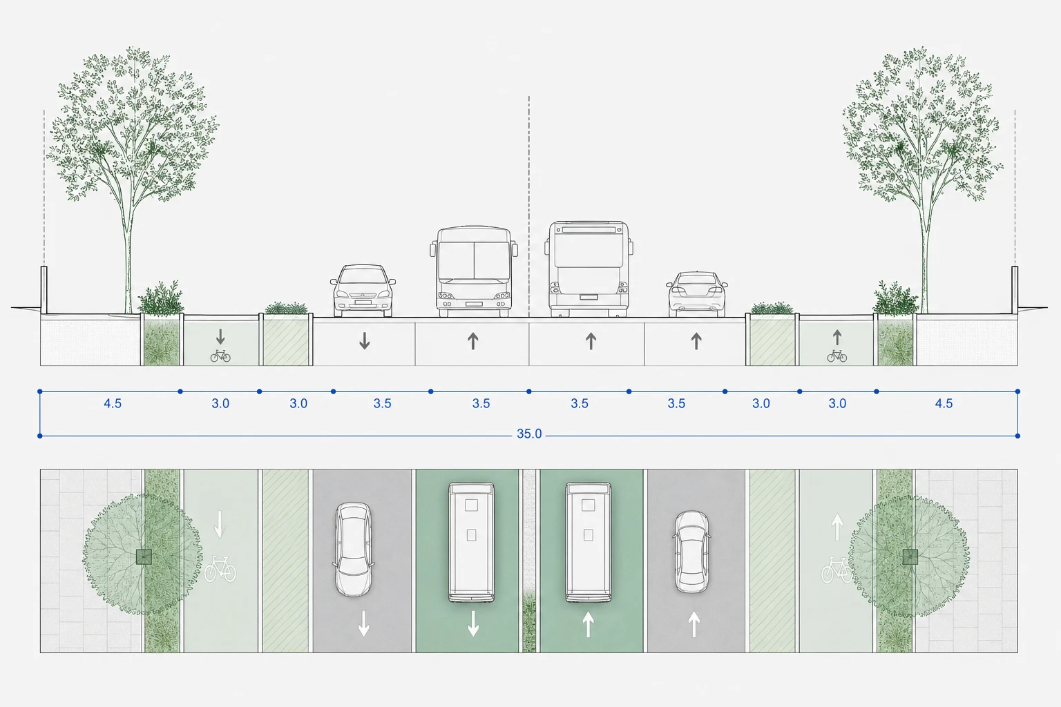
The guide's högfartsgata, the fast street at up to 40 km/h, is drawn as a 35 m section for Gillbergaleden, norra Fröslundavägen and östra Gillbergavägen. From the outer edge towards the centre it reads:
| Band, edge to centre | One side (m) | Both sides (m) |
|---|---|---|
| Pedestrian | 4.5 | 9 |
| Cycle | 3 | 6 |
| Flex (loading, furniture, bike parking) | 3 | 6 |
| Car lane | 3.5 | 7 |
| Public transport lane | 3.5 | 7 |
| Total | 17.5 | 35 |
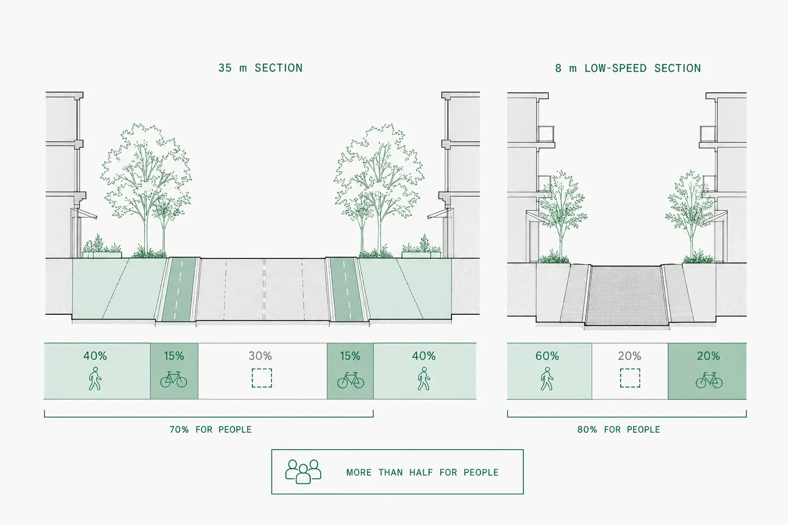
Mirrored about the centre, that is 35 m. Now the arithmetic the single-width ribbon never shows you. Pedestrian, cycle and flex come to 9 + 6 + 6 = 21 m. That is 60% of the width for walking, cycling and flexible use, against the guide's "over half". The four lanes of cars and public transport take the other 14 m.
In Spacio the mapping is mostly direct. The pedestrian zone is a Pavement band. The cycle track is a Bike lane band. The car and public transport lanes are a Roadway band, which carries a lane count and marking, so the central 14 m is one Roadway of four lanes. A Median band exists if you want one.
Two honest approximations. Spacio has eight band types (Plot setback, Pavement, Roadway, Bike lane, Safety zone, Planting, Parking, Median) and no flex zone, so the flex strip has to be a Pavement, Parking or Planting band, depending on what you want it to hold. And there is no separate bus-lane type; Spacio will not know which of the four lanes carries the 7 m of public transport, so that stays a note in your drawing rather than something the model enforces.
Each band has a width and a level, its kerb height relative to the carriageway. The guide's preference for one level translates into setting the levels to zero, which Spacio allows per band. Two of the built-in templates already work this way: the Shared street at 12.3 m and the Alley at 5 m.
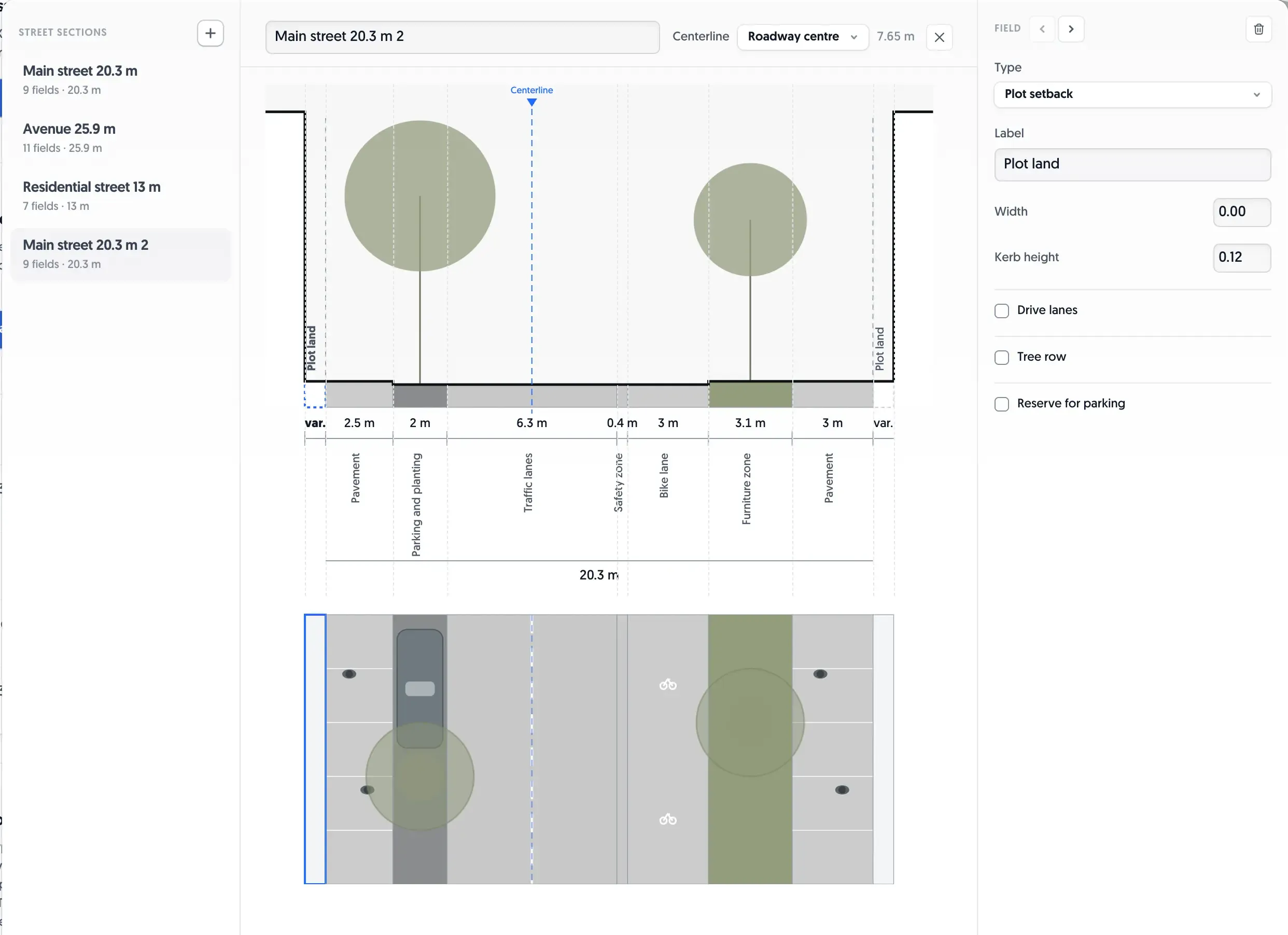
The editor draws the cross-section at true scale with a plan strip underneath on the same x-axis, so the fields line up. Parking shows bay dividers, planting shows tree canopies at their real spacing, roadways show lane markings. You can read the allocation of space off the drawing without a single label.
The same logic on a smaller street
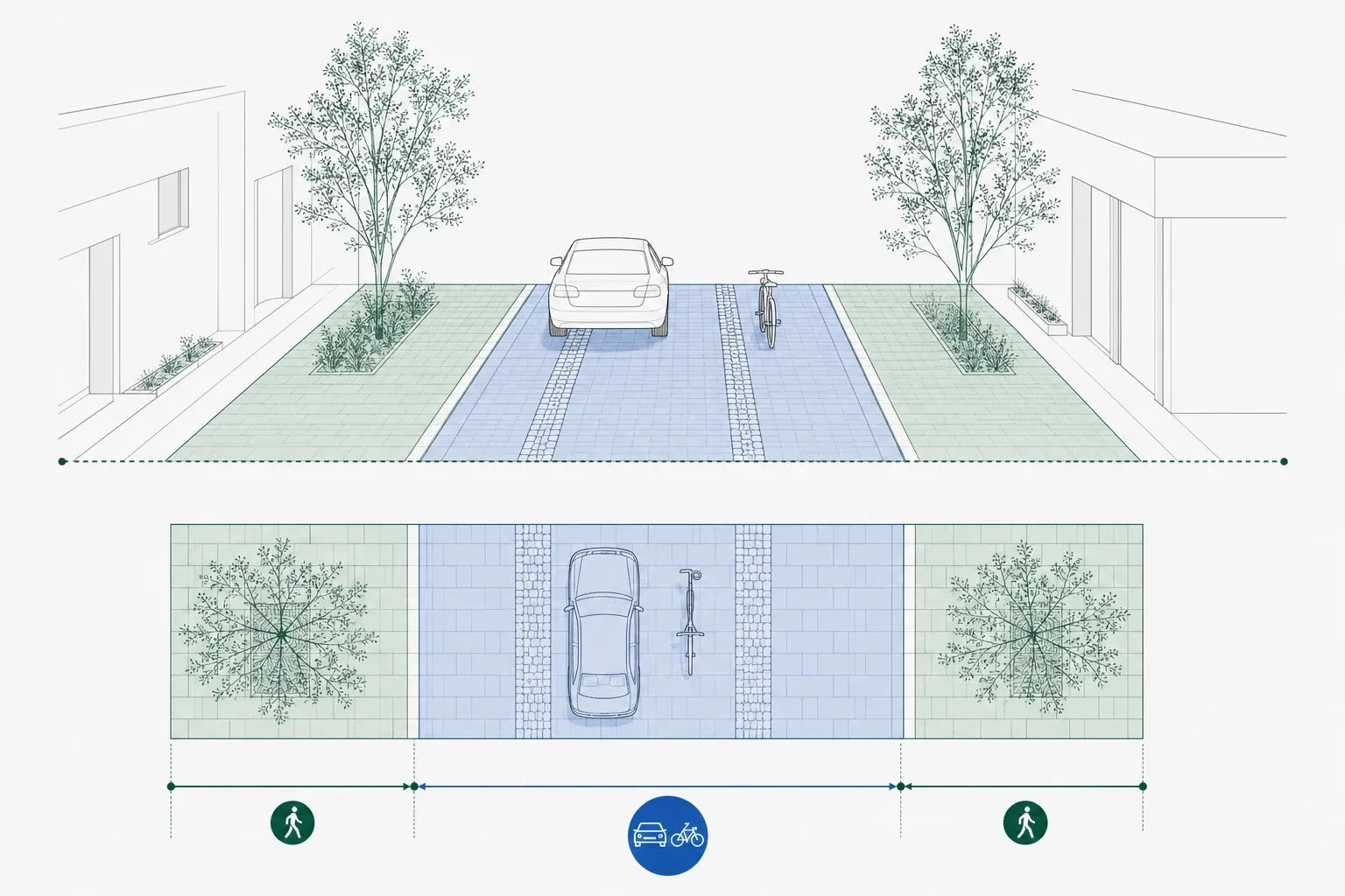
The guide gives a very different answer for a street where cars are guests. Its lågfartsgata for bike streets is only 8 m: 2 m of pedestrian zone, a 4 m shared strip for cycles and cars, and another 2 m of pedestrian zone, all on one level, with cobble strips under the wheel tracks to slow cars down.
That is two Pavement bands and one Roadway, levels at zero. Half the width is shared; the other half is people on foot. The point of putting it next to Section A is not that one is better. It is that they answer the same priority order at very different scales, and the difference between them is visible in the numbers rather than buried in a sentence about "a calm street".
For a feel of where Spacio starts you from, every new project ships with seven templates, widest to narrowest: Boulevard 33.4 m, Avenue 25.9 m, Main street 20.3 m (the default), Local street 17 m, Residential street 13 m, Shared street 12.3 m and Alley 5 m. The Main street, for example, is a 2.5 m pavement, a 2.0 m parking or planting band, 6.3 m of traffic lanes, a 0.4 m safety zone, a 3.0 m bike lane, a 3.1 m furniture zone and a 3.0 m pavement. Add up what it gives to people on foot and on bikes, and compare it with the guide's "over half". That is a quick exercise with a section, and an impossible one with a width.
What the section changes downstream
A street section is not a drawing exercise. Once a street has one, it travels.
- 3D. The section is swept along the street's centreline. Street trees are generated from the Planting bands, with the rows, spacing, tree height and canopy diameter you set (defaults are one row, 8 m spacing and 6 m height), and canopies overhang the neighbouring bands as real crowns do.
- Terrain. The full corridor width drives the street outline and the terrain deformation, so the ground is cut to the street you drew and not to a carriageway.
- Drawings. DXF export follows the corridor. The PDF plan draws the same street trees as the 3D view, and breaks terrain contours where they cross the corridor.
- Variants. Sections are shared across the project, so editing one updates every street that uses it, and hovering a section highlights the streets using it. Choose a section from the Street tool's picker, or select a street and use the mirror, edit and choose controls in the bottom toolbar. Swapping a street from one section to another is a change of assignment, not a redraw.
That last point is the one that echoes the guide's rebuildable street. Test beds on the ground, test sections on the model: you can try a wider walking zone on the same plot and see what it does to the plot edge, the trees and the terrain before the question reaches a drawing.
What Spacio does not do
Be clear about this before you use any of it in front of a client or a municipality.
Spacio does not check a street against the Smarta gator guide, or against any municipal street standard. The section is geometry and metadata. The guide supplies the principle; the section shows you the consequence of the allocation, and the judgement stays with you.
It also does not model everything in the guide. The stormwater function of a planting strip or a park street is not modelled, so a Planting band gives you trees, not a rain basin (soon solved when releasing in a few weeks our new Storm-Water-Tool). The guide's meandering drivable width on its walking-speed streets is not supported, because the sweep is constant-width along the path. Parking bands reserve a polyline for parking, they do not place cars. The guide's rule that a walking-speed street should not be narrower than the buildings are tall is not tested. Spacio does not calculate traffic capacity or cost from the bands either.
If you are working on a noisy street, the same section feeds the traffic noise work we published in September, where the street is the source. That is the only connection I will draw here.
Five questions to ask of any street section
You can use these on a Spacio section or on a drawing from any office. They come from the guide's principles, not from a tool.
- Does more than half the width go to walking, cycling and flexible use?
- Are the slowest, most vulnerable users at the edges and the fastest traffic in the middle?
- Is every lane at least 3 m, with 2.5 m of clear width left for maintenance and emergency vehicles?
- Can the street be one level, with colour or material doing the separation before a kerb does?
- Where do the trees stand, and what space do they have?
Section A passes the first test by arithmetic. Whether the street you are drawing does is a question worth answering while it is still cheap to change.
Try it
Open a project in Spacio, pick a template, and edit the bands until the allocation says what you meant. Build the 35 m and the 8 m from this post, and put your own plot's street next to them.
Sources
- Smarta gator: Fröslunda, Råbergstorp och Lagersberg. Underlag för kommande planering. Spacescape (lead Alexander Ståhle) for Eskilstuna kommun, 44 pp, in Swedish. Principles pp 6–8; Section A, the 8 m cycle street and the municipality's reference section. Translated and summarised by the author; only a few words quoted.
- Designguide för smarta gator (2022) and the research project Smarta gator (2019–2022), as applied in the document above; consulted only through it.
- Spacio street sections, introduced in August 2026.

Franz Forsberg